Kohistan Journey
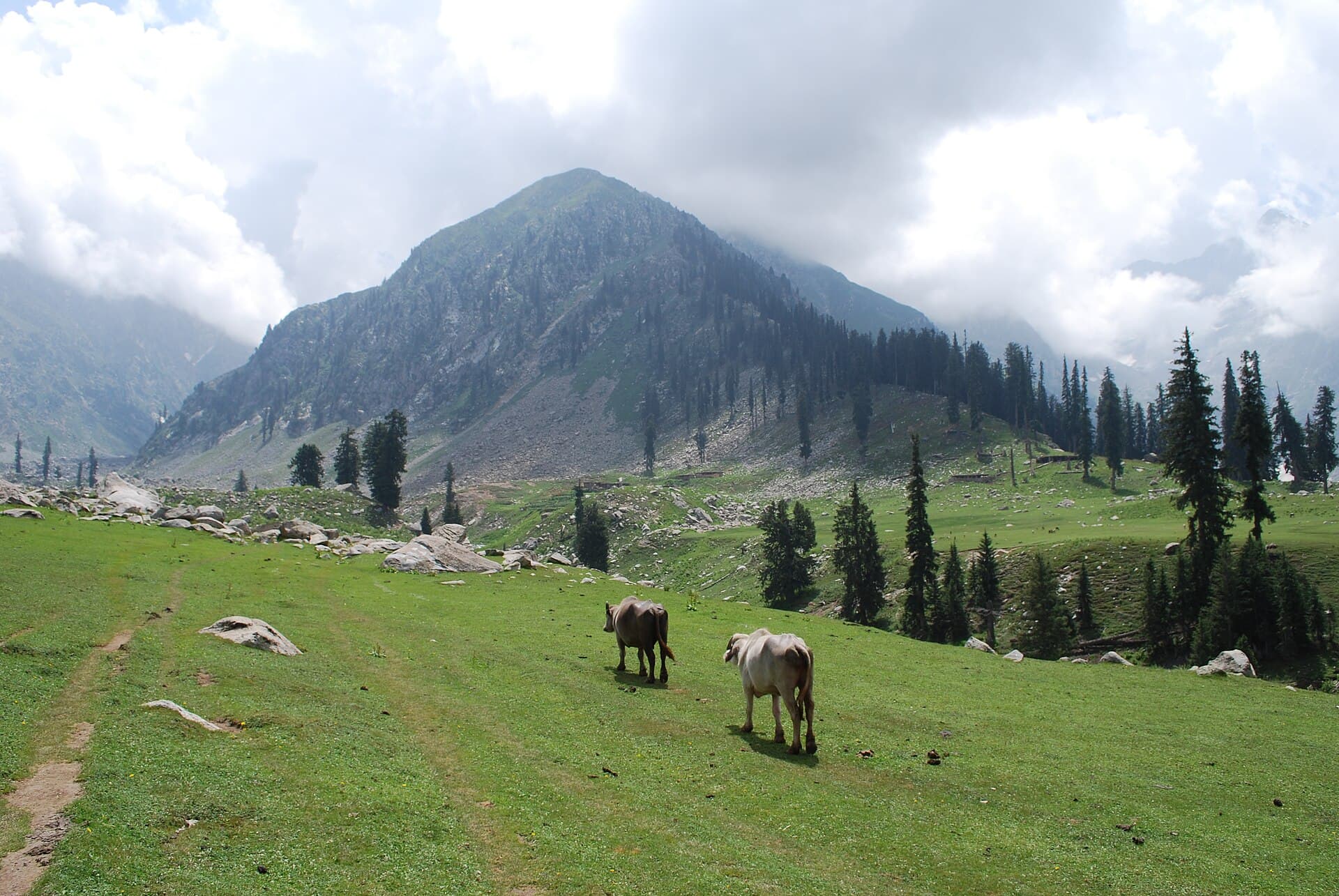
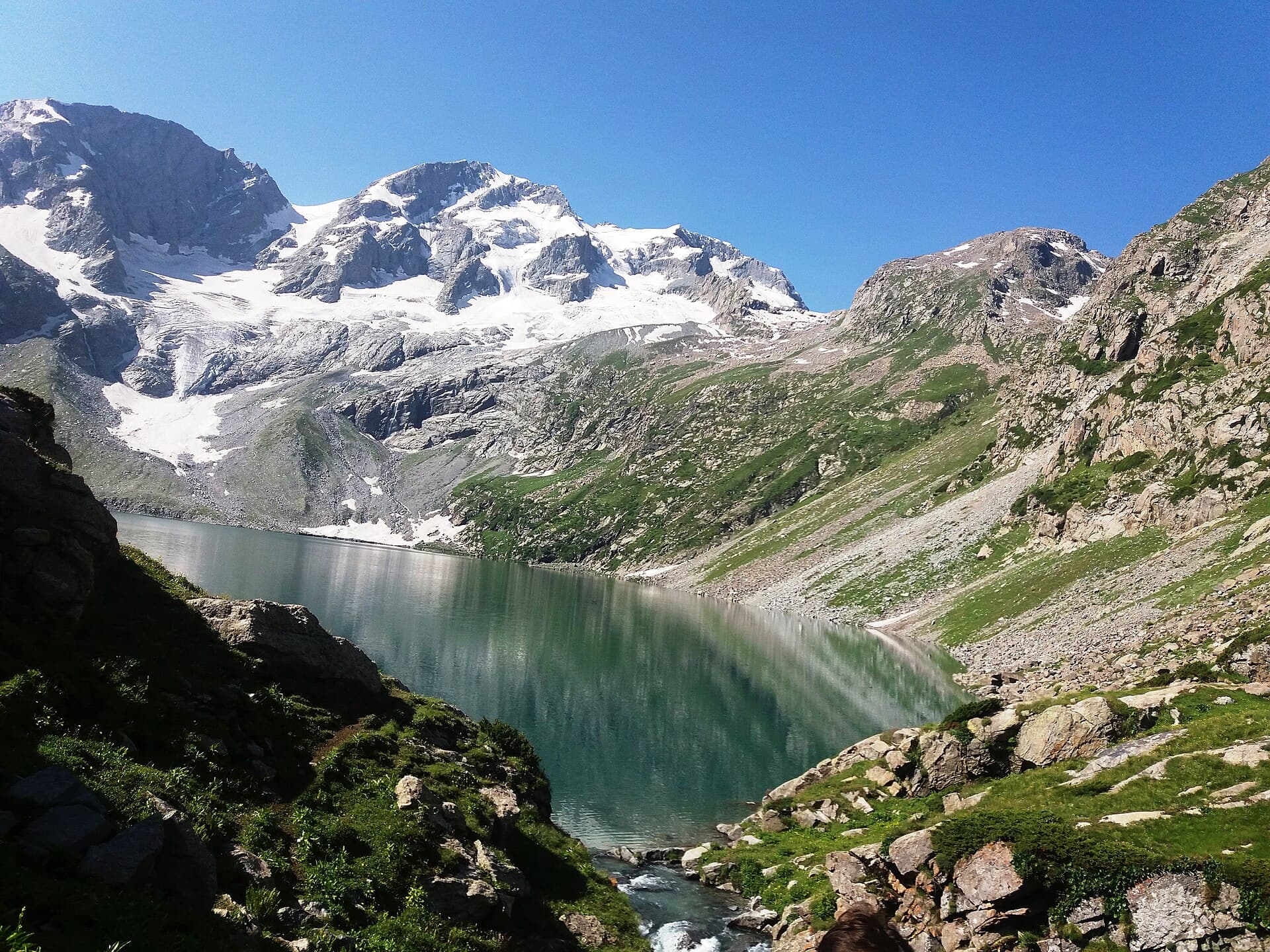
Rolling meadow at Jahaz Banda
ModerateNeeds verification

Jahaz Banda Trek

A ship-shaped alpine meadow above the Utror Valley.

Region
Khyber Pakhtunkhwa
District
Upper Dir
Distance
20 km
Duration
2 days
Max elevation
3,300 m
Best season
Summer
All treks
2 min read

Trek statistics

Distances and elevations are commonly-cited approximations. Anything we haven't confirmed is labelled rather than guessed at.

Khyber Pakhtunkhwa
Upper Dir
Meadow Trek
Moderate
20 km
2 days
2,000 m
3,300 m
1,300 m
10 km
Out and back
Rural
Summer
Recommended
Needs verification
Needs verification

About Jahaz Banda Trek

Jahaz Banda — the name translates roughly as 'ship's deck' — is a wide, flat-topped meadow reached by climbing from Thal in Upper Dir. The walk takes most of a day and gains a good deal of height, but the ground is grass and dirt rather than rock, which makes it far friendlier than its distance suggests. The meadow is used as summer grazing and as the staging point for the further climb to Katora Lake, so it sees both shepherds and trekkers through the season.

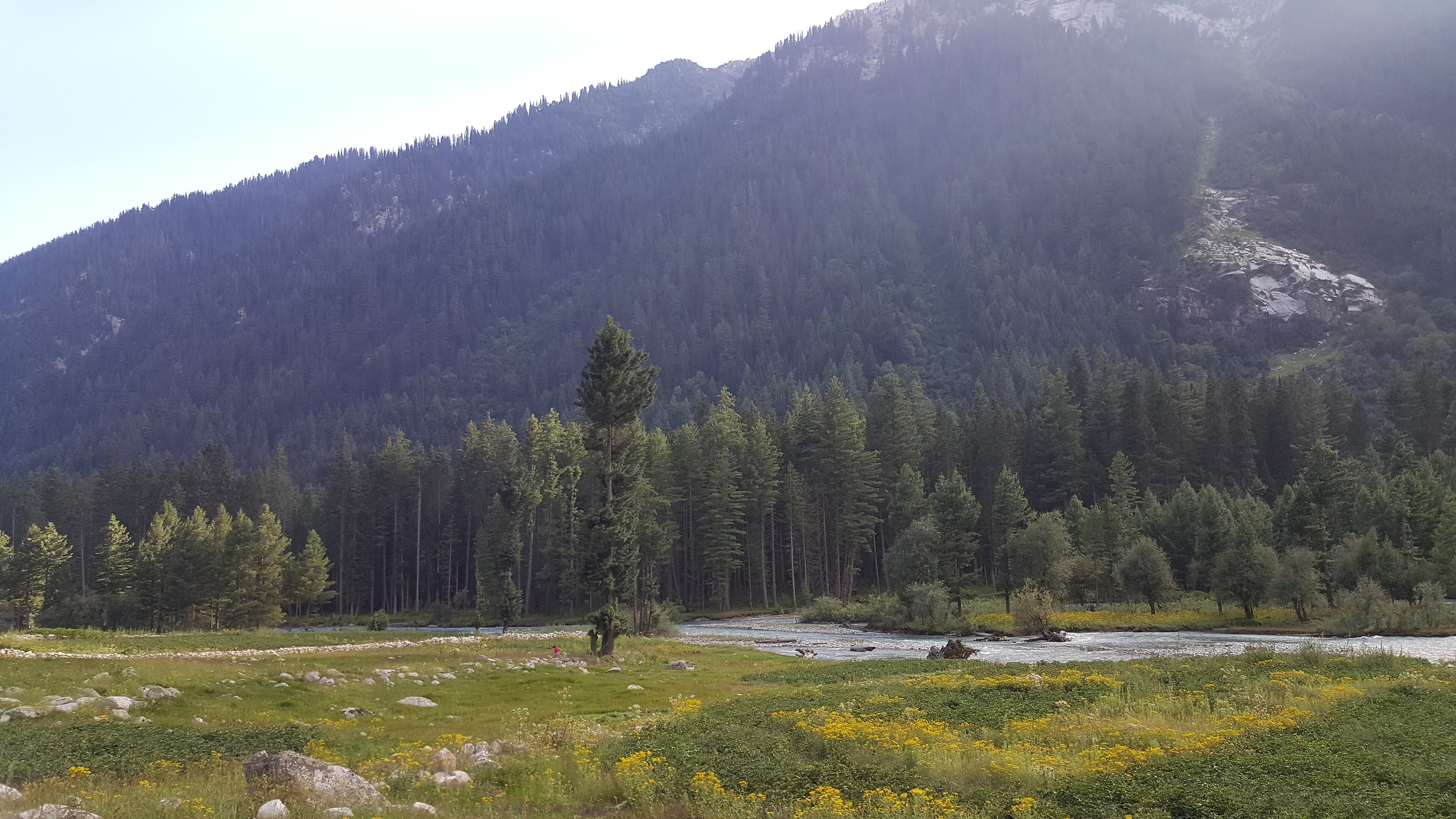
Pine forest on the climb, opening onto a broad, gently sloping alpine meadow ringed by rock ridges.

Walkers with reasonable stamina looking for a first overnight trek.

Thal, Upper Dir

Jahaz Banda meadow

Key highlights

  • A wide, flat alpine meadow at around 3,300 m
  • Forest walking on the approach from Thal
  • A natural base for continuing to Katora Lake
  • Summer shepherd settlements on the meadow

Why walk this one

One of the largest and most striking meadows in the region, and an unusually comfortable place to spend a night at altitude.

Rolling meadow at Jahaz Banda

Along the Jahaz Banda Trek

Pine forest on the climb, opening onto a broad, gently sloping alpine meadow ringed by rock ridges.

How demanding is this trek?

Kohistan Journey's own editorial banding — not an official or standardised mountaineering grade.

ModerateNeeds verification

A long approach with steady height gain, on ground that stays forgiving throughout. Fitness is the limiting factor rather than skill.

Assessed by
Kohistan Journey editorial assessment
Reviewer
Kohistan Journey editorial team
Last reviewed
Needs verification

What makes it this hard

  • Around 20 km return with roughly 1,300 m of ascent
  • Path is mostly dirt and grass, with some rockier sections
  • Meadow sits at around 3,300 m
  • No technical ground or exposure

The published numbers for this route alone would suggest Challenging. The grade above reflects an editorial judgement as well — treat both as indicative and seek local advice.

Difficulty here describes the route in good conditions. Snow, high water, and weather can make any trek on this site significantly harder than its grade suggests, and none of those are tracked on this page.

Elevation profile

An indicative shape of the climb, drawn from published route descriptions — not a surveyed GPS track.

Needs verification
View the profile as a table
PointDistanceElevation
Thal0 km2,000 m
Forest section4 km2,500 m
Upper forest7 km2,950 m
Jahaz Banda10 km3,300 m
10 km shown · 2,000 m to 3,300 m. Distances between points are approximate and have not been surveyed.

Route summary

What the ground underfoot is like, and how the route is shaped.

Thal, Upper Dir
Jahaz Banda meadow
Out and back
Rural
  • Dirt trail
  • Forest floor
  • Meadow grass
  • Rocky trail

Trail map

Interactive mapping arrives with verified GPX tracks in a later phase.

Trail map coming in a later phase

We will publish a route line only once we have a GPX track we can stand behind. An approximate line drawn from memory would be worse than none on a route this remote.

Route waypoints

The main points along the route in order. Timings are rough guides from published descriptions, not a schedule.

  1. Thal

    VillageNeeds verification

    The village in Upper Dir where the walk begins.

    Elevation
    2,000 m
    From start
    0 km
  2. Forest climb

    Rest pointNeeds verification

    A long, shaded ascent through pine forest.

    Elevation
    2,500 m
    From start
    4 km
    From previous point
    Around two hours
  3. Jahaz Banda meadow

    DestinationNeeds verification

    The flat meadow top, used for summer grazing and as a camping ground.

    Elevation
    3,300 m
    From start
    10 km
    From previous point
    A further two to three hours

When to walk this route

General seasonal patterns only. Snow cover, river levels and pass openings vary year to year and are not tracked here.

Spring

Limited

The upper meadow often still holds snow.

Summer

Recommended

Autumn

Possible

Cold at night; the season ends quickly.

Winter

Usually inaccessible

Planning notes

General planning guidance for this route. None of it describes current conditions.

Altitude and acclimatisation

3,300 m is high enough to disturb sleep on a first night. Go slowly on the climb.

Navigation

The route is well used in season and generally easy to follow in clear weather.

Water

Streams are frequent on the climb. Treat what you collect.

Camping

The meadow is grazing land as well as a campsite. Pitch away from livestock routes and pack everything out.

Hazards to plan for

General hazards inherent to this kind of route. This is preparation guidance, not a live conditions report or a substitute for local advice.

Altitude sickness

AltitudeSerious severityNeeds verification

Above roughly 2,500 m, altitude sickness becomes a genuine possibility regardless of fitness. Headache, nausea, poor sleep, and breathlessness are common early signs, and they can progress to conditions that are life-threatening.

Preparing for it: Ascend gradually, build in rest days, drink plenty of water, and descend if symptoms worsen. This is general awareness — talk to a doctor about your own situation.
Rapid weather changes

WeatherHigh severityNeeds verification

Mountain weather in northern Pakistan can turn within an hour. Clear mornings routinely become snow, rain, or high wind by afternoon, especially at altitude.

Preparing for it: Start early, carry full weather protection regardless of the forecast, and be willing to turn back. This site does not publish live weather.

Sustained physical effort

Physical exertionModerate severityNeeds verification

Long days of climbing with a pack are harder than the distance suggests, and fatigue is where most avoidable mistakes happen.

Preparing for it: Train with a loaded pack beforehand, and plan shorter days than you think you need.

Cold and night temperatures

Cold exposureHigh severityNeeds verification

Night temperatures at camp can fall well below freezing even in mid-summer, and wind chill on exposed sections makes it feel considerably colder.

Preparing for it: Carry more insulation than a summer date suggests, and keep a dry set of clothing for camp.

Equipment for this route

A general kit list for a route of this type. Adjust it to the season, your own experience, and advice from a local guide.

Footwear

  • Sturdy, broken-in trekking bootsEssential

    New boots on a multi-day route is the most common avoidable injury on these trails.

  • Light camp shoesRecommended
  • Three or more pairs of trekking socksEssential

Clothing layers

  • Thermal base layersEssential
  • Insulated jacket (down or synthetic)Essential
  • Waterproof and windproof shellEssential
  • Gloves and warm hatEssential

Shelter and sleep

  • Four-season tentEssential

    Unless your operator is carrying group tents — confirm this before you leave.

  • Sleeping bag rated well below the expected lowEssential
  • Insulated sleeping matEssential

Navigation

  • Paper map and compassEssential
  • GPS or offline mapping on a phoneRecommended

    As a backup to the map, not a replacement — batteries fail in the cold.

Safety and health

  • Comprehensive first-aid kitEssential
  • Water purification (filter, tablets, or boiling)Essential
  • High-factor sunscreen, lip balm, sunglassesEssential
  • Head torch with spare batteriesEssential
  • Satellite messenger or emergency beaconRecommended

    Mobile coverage is absent across most of these routes.

Documents

  • Passport, ID, and copiesEssential

    Some areas require registration. Check current requirements locally before travelling.

  • Travel and evacuation insurance detailsRecommended

Packing checklist

A starting point to adapt, not a complete list. What you actually need depends on the season and how self-sufficient your group is.

Clothing

  • Base layers
  • Fleece or mid layer
  • Insulated jacket
  • Waterproof shell
  • Gloves
  • Warm hat
  • Sun hat

Sleeping

  • Sleeping bag
  • Insulated mat
  • Tent or confirmed group shelter
  • Liner

Cooking

  • Stove and fuel
  • Cook pot
  • Bowl, mug, spoon
  • Enough food for the full route plus a spare day

Safety

  • First-aid kit
  • Head torch
  • Water treatment
  • Map and compass
  • Emergency communication device

Personal

  • Sunscreen
  • Lip balm
  • Toiletries
  • Rubbish bag for all your waste

Facilities along the way

Availability changes with the season and from year to year. Plan to be self-sufficient rather than relying on anything listed here.

  • Mobile networkNeeds verification
  • Camping groundNeeds verification

    Camping on the meadow; nothing formally provided.

  • FoodLimited

    Seasonal only.

  • Drinking waterNeeds verification
  • Porter serviceNeeds verification
  • Medical postUnavailable

Is this trek right for you?

An honest read on who this route works for. If you are unsure, it is worth asking a local guide before committing.

Beginners
Partially suitable
Families
Partially suitable
Children
Not suitable
Older trekkers
Partially suitable
Solo trekkers
Suitable
First time at altitude
Partially suitable
Minimum fitness
Moderate
Recommended experience
Some hiking
Technical skills required
No
Wheelchair accessible
Not accessible
Rolling meadow at Jahaz Banda

Worth the walk

One of the largest and most striking meadows in the region, and an unusually comfortable place to spend a night at altitude.

Reaching the trailhead

Road status, transport schedules and permit rules change frequently. Nothing here is a live status — confirm locally before you travel.

Thal, Upper Dir
Thal
Road to Thal, then on foot or by mule
Needs verification
Needs verification
Needs verification

Road conditions are not tracked live on this site.

Trekking responsibly

These routes pass through places people live and work. How visitors behave has a direct effect on both.

  • Carry every piece of rubbish back out, including food waste, wrappers, and tissue.
  • Stay on the established path — braided trails across alpine meadow take years to heal.
  • Ask before photographing people, homes, or livestock.
  • Camp well away from streams and lakes, and leave no trace of your pitch.
  • Use a stove rather than firewood; juniper and birch here regrow very slowly.
  • Pay porters and guides fairly, and check the loads they are being asked to carry.

Frequently asked questions

Can I combine this with Katora Lake?

Yes — Jahaz Banda is the usual staging point for the further climb to Katora, which makes a natural three-day trip.

Are mules available for luggage?

Mules are commonly used on this route, but we do not publish availability or rates because they change locally.

Before you rely on this page

Kohistan Journey publishes background research, not live mountain information.

Verification statusNeeds verification
Last reviewed
Needs verification
Source type
Published route descriptions and public geographic references
Reviewer
Not yet assigned

This page does not report current trail conditions, snow cover, river levels, weather, or route closures. None of those are tracked here, and any of them can make a route impassable or dangerous.

This route reaches above 3,000 m. Altitude affects people differently and can become serious quickly. This is general awareness, not medical advice — speak to a doctor about your own situation.
We do not publish permit requirements, guide certifications, porter rates, rescue availability, or emergency numbers, because we cannot keep them accurate. Confirm all of these with local authorities and operators before you travel.

For remote and high-altitude routes, a local guide is not just a convenience — they know the ground, the weather patterns, and the people, in ways no website can replace.

Media attribution

  • Rolling meadow at Jahaz BandaPhoto: Mafu75CC BY-SA 3.0Source
View full site attribution list