ModerateFeatured
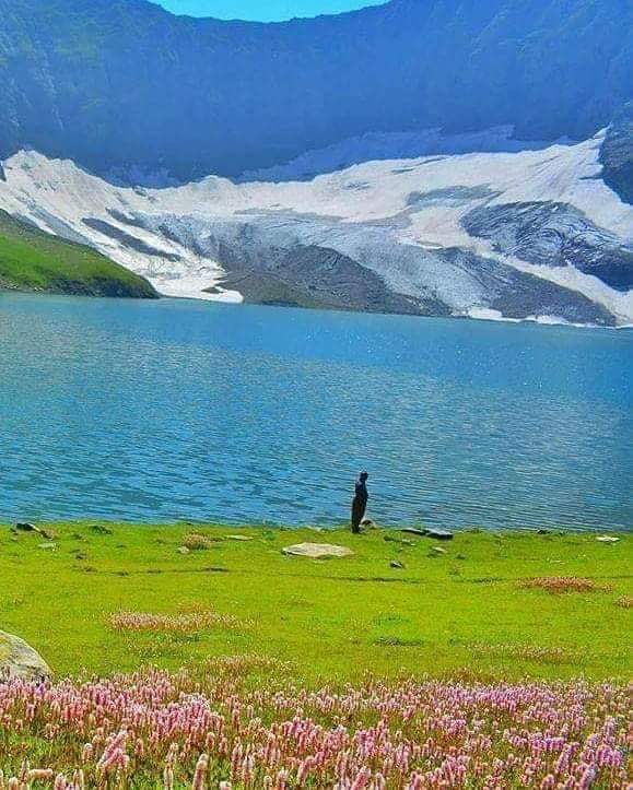
Needs verificationRatti Gali Lake Trek
A glacial lake trek above the Neelum Valley, reached via Dowarian.
- Distance
- 10 km
- Duration
- 1 day
- Max elevation
- 3,700 m
- Guide
- Recommended
Best in SummerView Trek
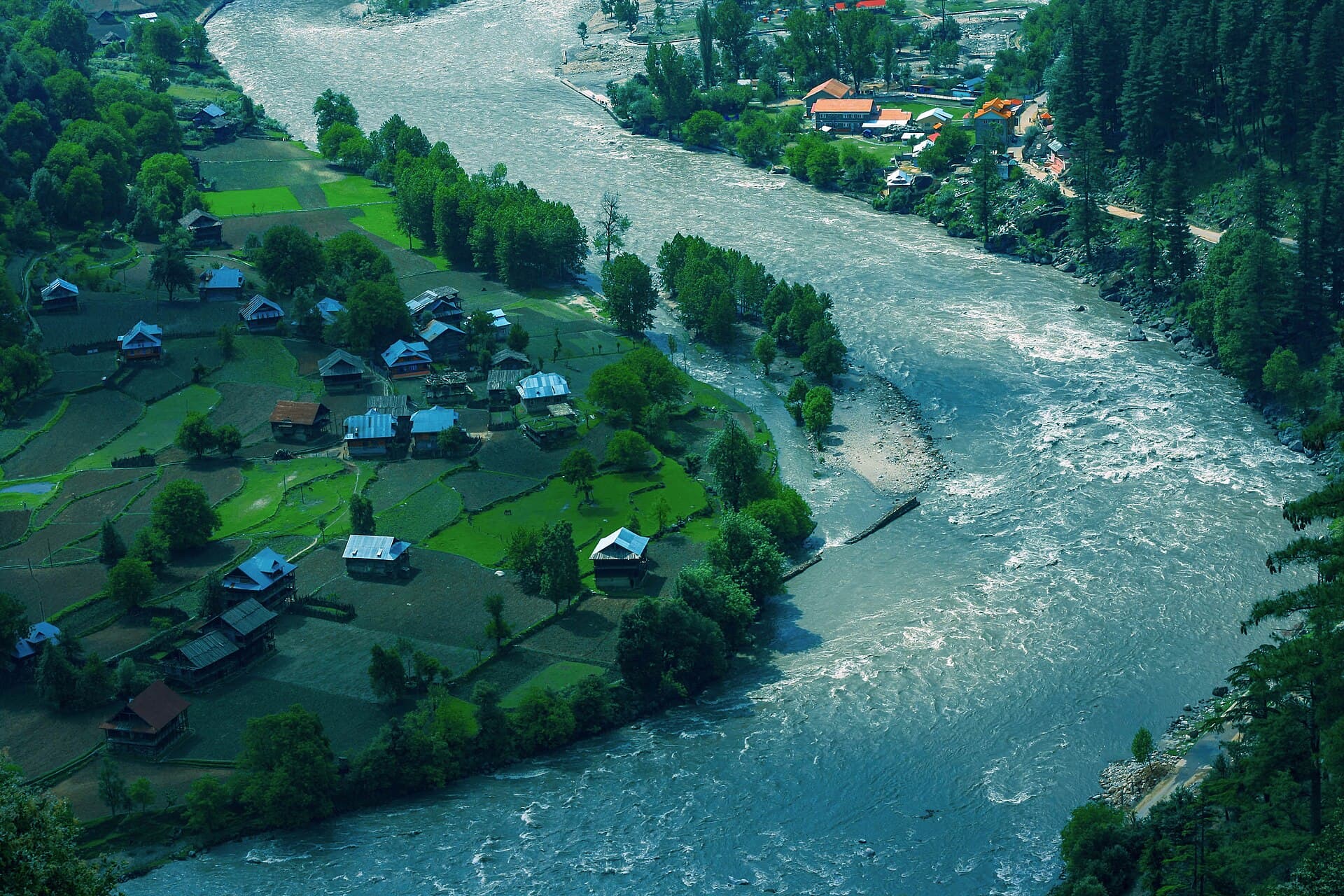
A long, forested valley following the Neelum River, dotted with waterfalls.
Anything we haven't confirmed is labelled clearly rather than guessed at.
Often described as one of the most scenic drives in Azad Kashmir, the Neelum road follows the river through a series of villages — Kutton, Keran, Sharda, Kel — each a possible stop or base. The valley narrows and widens repeatedly, with pine forest crowding the road in places and open river flats in others, and side trails climb from several points toward higher meadows and lakes.
The valley narrows and widens repeatedly, pine forest crowding the road in places and open river flats in others.
A long river valley with dense pine forest, terraced fields near villages, and steep side valleys leading to higher meadows and lakes.
Kashmiri and Gujjar communities along the valley, with a history shaped by its position near the Line of Control.
Families and travellers wanting a multi-stop valley road trip
A multi-day drive with stops at villages and side-valley trailheads
Estimated visit length: 3-4 days
Every photo is real and credited — see the attribution section below for the full list.
A long river valley with dense pine forest, terraced fields near villages, and steep side valleys leading to higher meadows and lakes.
Each stop along the Neelum road — Kutton, Keran, Sharda — has its own character and river views.
The valley suits a slower drive with several short stops rather than a single destination.
Both Arang Kel and Ratti Gali Lake are reached via side trails from the Neelum road.
Availability is seasonal and not confirmed as currently operating — see each activity's verification status.
Short stops at Kutton, Keran and Sharda for river views and local food.
Historic ruins near Sharda village associated with the ancient Sharada Peeth site.
Upper valley sections may be affected by snow — needs verification.
Seasonal access and weather conditions may change. Verify locally before travel.
Based on the data we have — uncertain relationships are marked for review rather than presented as confirmed.
A riverside village facing Indian-administered Kashmir across the Neelum River.
Distance needs verification
Home to the historic Sharada Peeth-associated ruins.
Distance needs verification
The last major village before the valley's upper limit.
Distance needs verification
A structural preview only. Detailed routes, driving times and road quality are coming in Phase 5.
Interactive route map
Detailed routes coming in Phase 5
Availability is never claimed without evidence — unconfirmed facilities default to unknown or needs-verification.
Weather and trail conditions change without notice and are not tracked live on this page. Check current conditions before travelling.
Road conditions are not currently verified. A local guide is recommended for remote or high-altitude sections.
Written factually, without claiming accessibility we haven't confirmed.
Kashmiri and Gujjar communities along the valley, with a history shaped by its position near the Line of Control.
A glacial lake trek above the Neelum Valley, reached via Dowarian.
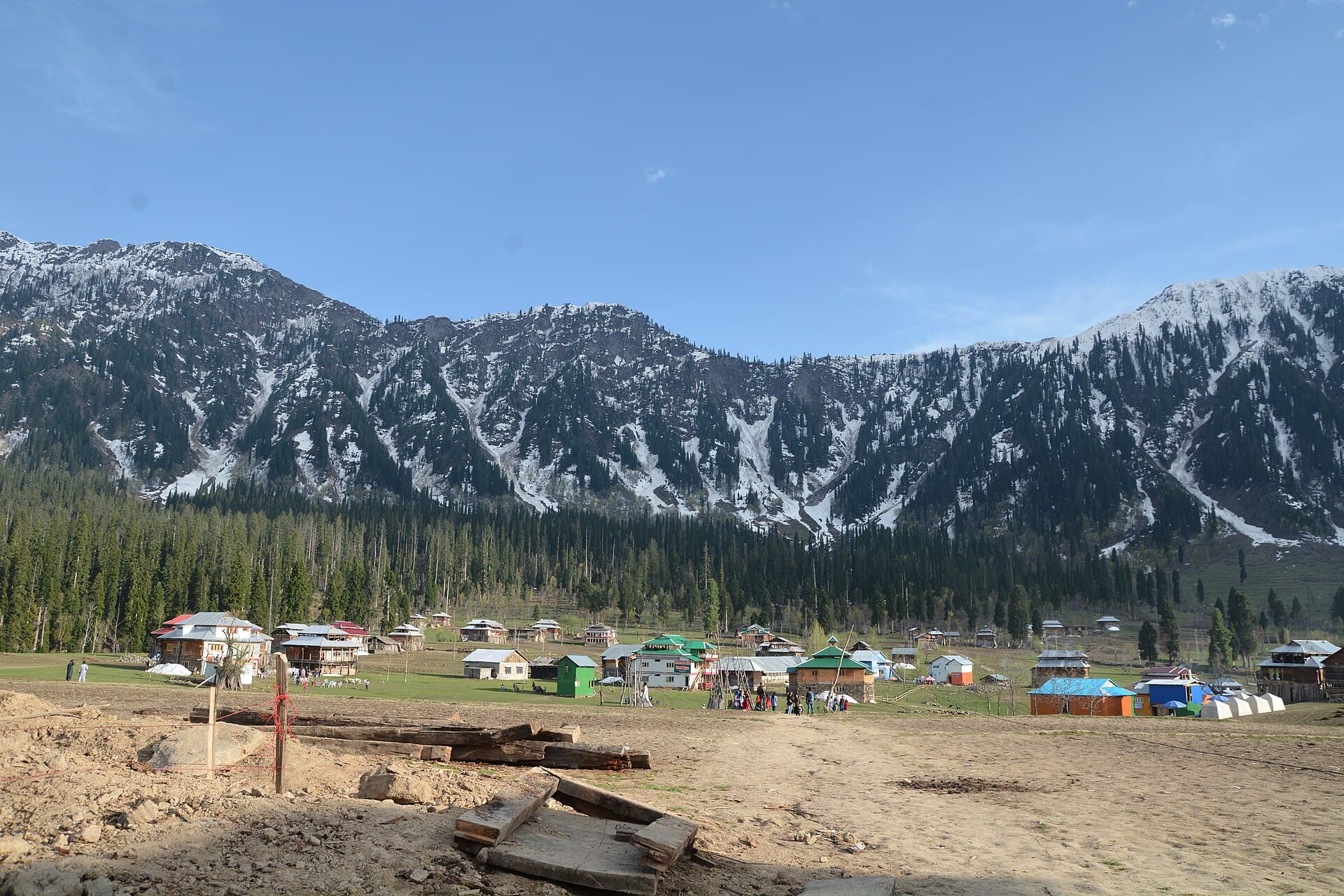
A short, scenic climb from Kel to the meadow hamlet of Arang Kel.
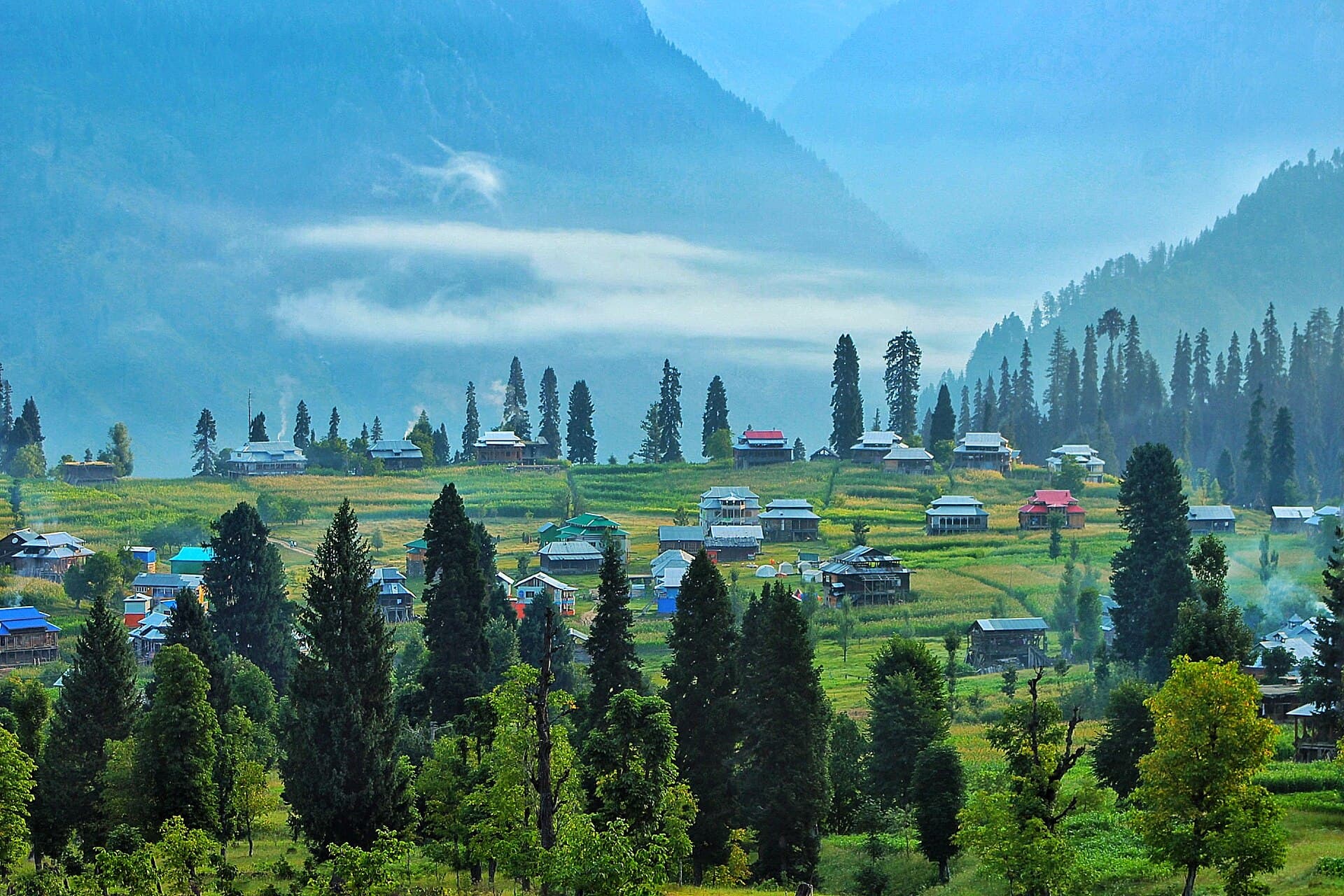
A hilltop meadow hamlet above Kel, reached on foot or by chairlift.
A high alpine glacial lake above the Neelum Valley, reached via Dowarian.
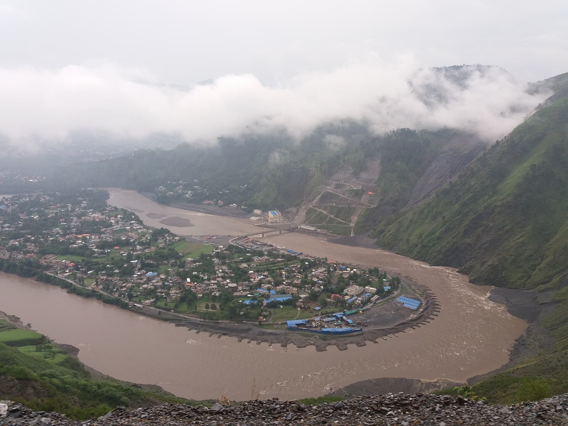
The capital of Azad Jammu and Kashmir, where the Neelum and Jhelum rivers meet.
Spring and summer, when the full valley road is most likely to be open.
3-4 days to see multiple villages and side valleys.
Needs verification — parts of the valley are near the Line of Control; check current requirements before travel.
What people who have been to Neelum Valley have shared. Everything below is a traveller's own account, not Kohistan Journey's verified information.
I grew up in Neelum Valley and now live in Muzaffarabad, so most summers I take a group of friends who've never been up the valley properly and show them the drive I took for granted as a teenager. This year it was three friends from university. We didn't rush the road, which is the whole point of this kind of trip — the valley narrows and opens repeatedly as you go, with the river alongside for almost the entire drive, and stopping wherever looked good mattered more than reaching any particular endpoint. We passed through Kutton and Keran and stopped for tea at a small place in Sharda that I've been going to since I was a child, mostly because the owner still remembers my father. My friends kept asking why I hadn't brought them here sooner. I didn't have a good answer beyond that when a place is home, you sometimes forget it's worth showing people. We turned back before Dowarian rather than continuing further up the valley — this trip was about the drive and the villages along it, not about pushing to any particular destination, and I think that restraint made it a better trip than trying to do everything in four days would have.
Be the first to share a photo from Neelum Valley.
Share a photoThere were several small roadside tea stalls operating between Muzaffarabad and Sharda during our June 2025 drive. Hours and availability are informal and can change, so don't plan a trip around any specific stop being open.
Traveler-reported — not independently verified.
Traveller reports may be outdated or unverified. Confirm critical information locally before travel.
Photographs shared by travellers who have been here. Personal accounts, not Kohistan Journey's verified information — check anything time-sensitive locally.
No traveller posts yet
Nobody has shared a photo tagged to Neelum Valley yet. If you have been, you can be the first.